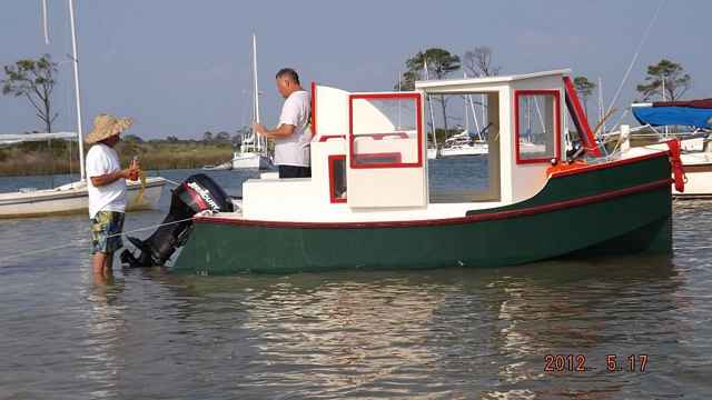
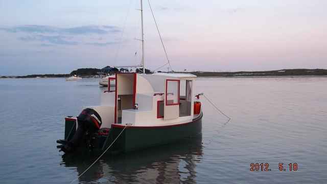
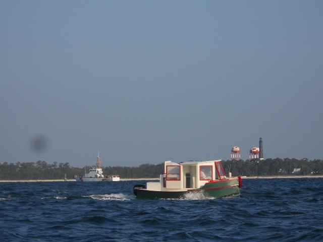
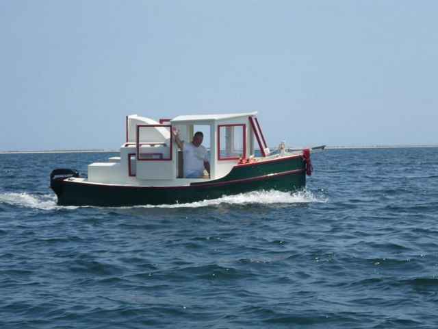
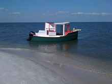
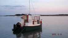
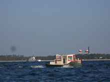
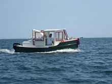
| Vessel - "Little Debbie" (A Bolger Micro Trawler) Built by Me - Completed 2012
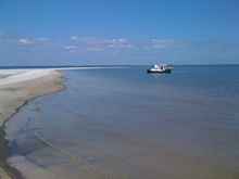
I had been thinking about the Barrier Island trip for a couple years. I just knew the Bolger Micro Trawler would be a great boat for the trip. The shoreline on the north side of the islands (sound side) was shallow and extended a hundred feet or more into the relatively shallow Mississippi sound. That prevents many big boats from spending much time on or around the islands. But I had a boat that drew less than 2 feet with the motor down and only about a foot with it trimmed up. I did some initial exploratory work and research (due diligence) and determined that the trip was well within the bounds of virtually any boat as long as the captain was smart enough to take the weather into account. The islands are all 8-12 miles offshore but they are less than 5 miles apart end to end (East to West). Consequently a boat can be trailered to Fort Morgan on the east side of Mobile Bay or Dauphin Island (Alabama Barrier Island) on the West side of Mobile Bay ensuring there is never a point that the boat will be more than a couple miles from a shore. Dauphin Island is the only island in the chain that can be accessed by road. From there the trip can follow the sound side of the Barrier Islands and make short crossings from end to end when and if the weather looks good. You can actually see the next island on most days if the weather is clear. The trip would never be more than 2.5 miles from shore.
I came across a wonderful website that is a very comprehensive guide to the Barrier Islands. I used this website as the primary source for preparations & information regarding my trip. I also took a shoreline drive to scout the available boat ramps and supply sites should they be needed. I initially thought of departing from Pensacola but that added at least one full day to the beginning and end of the trip and I later decided I wanted to spend all the time in the Barrier islands instead. I decided to launch at Fort Morgan on the east side or Mobile Bay. Fort Morgan is on the tip of the spit of land that juts out into Mobile Bay from the east and pinches the Bay’s exit to the Gulf down to about 2 miles between the Fort & Dauphin Island that pinches in from the west side. There is a nice boat ramp 100 yards to the west of the car-ferry loading zone (Car-Ferry from Fort Morgan to Dauphin Island) and has a tall sea-wall that protects it from the waves from all sides. The sea-wall corral is large enough to contain several boats as they launch & load in the calm waters within.
I was determined to do some Gulf Side exploration as well as cruise the shallow sound sides of the islands. So my route would take the Micro Trawler out into the Gulf when weather permitted. I figured I could explore the northern side of the islands on the return trip. The sound side of the islands blocks the swells that are never ending on the Gulf side of the islands so that would be where I would anchor each night. Having opted to go “Around Alone” I was able to be very versatile with regard to departure and return times and dates. This is probably the best safety strategy available. I rarely have problems when boating but the few times I have had them it was directly linked to inflexible schedules and bad decisions that inevitably come with them.
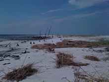
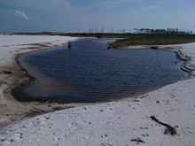
The weather window was good with respect to temperature and the winds although a little high and from the east and west. So I launched from Fort Morgan on the east side of Mobile Bay on Tuesday morning and headed west. The winds were coming from the west and the waves were rather steep & choppy due the 100 mile fetch to the west. Still my boat was able to slush through them without too much discomfort. I cruised between 5 & 7 mph and stopped near the end of Dauphin Island to wait a while on the nice beach to see if the winds & waves might calm down a bit before my first crossing. They didn’t look any different after a couple hours so I pressed on. I wanted to make it to at least Pettit Bois Island for the first night. After a bumpy ride across the short 3 mile crossing I explored the north side of the island and settled on the eastern end to anchor for the night. Pettit Bois has no trees and isn’t very high out of the water. I liked it for beachcombing but there were few natural features other than the marsh grass and sea oats.
Wednesday morning was cool and pleasant. The weather promised to be great with easterly winds that would be behind me all day. I pushed off and cruised to the northwest end of Pettit Bois where I could see the spoil island a few hundred yards to the west and on the other side of the Pascagoula Ship Channel leading out to the Gulf. The spoil island was probably the best place to anchor in the area because there is a large deep water cove on the west side with protection from any direction but west. A good thing to keep in mind since there are few anchorages that protect from northerly winds without having to anchor on the Gulf side and deal with the swells & breakers. I cruised the gulf side of the spoil island drinking coffee and enjoying the morning. I was able to see Horn Island within a few minutes to the west of me. An hour or so later I was approaching the northeastern end of the island and could see that there were a lot of trees & vegetation on Horn. I stopped for a quick look at the Government Dock sticking out to the south from the middle of the island’s south shore. This would definitely be one of the islands you could spend a week exploring. There are relics/remains from the past on this island as well as wildlife and beachcombing opportunities. A small part of the island is closed to the public due to recently discovered asbestos & mustard-gas particles in the sand around a military area called the Chimney. I wasn’t particularly worried about the hazardous issue and didn’t have a chance to get near the area anyway. I wanted to move along and see the other islands.
East Ship Island was the next island in the chain and it turned out to be my favorite of the trip. Probably the least visited due to its proximity to West Ship Island that has the Ferry Service, Fort Massachusetts, fresh water showers…… East Ship island’s many trees have all been killed by recent hurricanes but are mostly still standing (without their tops). The dunes are high enough to have captured a lot more floating debris from the many storms that wash over the islands so the beachcombing opportunities are really good. The typical anchorage on the northern side of the island allows for near shore anchoring. The water gradually gets shallower from 4ft about 100 yards out to 1 foot deep within 20 feet of the beach (typical at most of the islands). I wished I had brought a beach umbrella. I had a plastic resin chair for sitting on the beach but no shade. The temperature and breeze made the beach near perfect but the sunshine was bright and I didn’t want to get burnt. There was shade on the boat so I moved on and made West Ship Island within a half hour and stopped to see the Fort. The Ferryboat runs from Biloxi to West Ship Island twice in the morning and twice in the afternoon during the summer but I don’t know if it was running while I was there. The Fort & restrooms were locked up. The Ferry pier turns into a boardwalk that crosses the island to the south and provides easy access to the Gulf Side beach where there are freshwater showers (that were working;-). I didn’t see anyone but there was a ranger house beside the boardwalk and evidence that someone lived there.
 |
|
 |
|
 |
|
 |
|
 |
|
 |
|
 |
|
 |
|
 |
|
 |
|
 |
|
 |
|
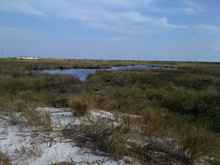
After retuning to the boat I headed for most westerly island in the Mississippi chain, Cat Island. The winds had picked up to near 15mph but were still from the east so although I did a lot of surfing on the steep 2-3ft chop I made easy progress and within an hour was near the center of the north/south stretch of the T-shaped island. I cruised in close to the shore and rounded the northern tip to get into the lee of the island where the water was calm and protected. As I headed south along the shoreline I saw a Shipwrecked boat on the shore and made a note to stop and look on the way back. The middle of the island where the island goes west has a lot of trees on it and in the inside of the corner of the northwest side is a canal system that the inhabitants use for boat access to their home.
These canals are several feet deep and provide protected anchorages for boats at the expense of exposure to the mosquitoes (in the warmer months). After exploring the canals I headed back to the shipwreck to anchor for the night. I actually anchored almost to the northernmost part of the island to ensure no mosquitoes and then walks the beach back to see what there was to see of the boat. I knew the boat would be all but gutted from previous scavengers but was surprised to find that it was made almost entirely of aluminum and probably had a thousand pounds or it still intact. The aft end of the boat had been removed for salvage but the cabin forward was still in reasonably good shape. The boat originally was probably 25-30ft in length. I did some more exploring before having happy hour and watching the sunset. There is phone service at all the islands and my I-Phone was able to connect to the internet at most of them. Consequently I was able to use my laptop (via I-Phone connection) to keep up with folks on Face book & email. The forecast called for 20+mph winds from the north on Sunday which caused me to be a little more insistent on a rather aggressive timeline to ensure I saw the islands but made it back easily by Saturday so I could avoid the high Sunday winds.
On Thursday I left Cat Island and headed back towards Ship Island. The winds were 10-15mph from the east/northeast so in my face again. I opted to travel along Ship Island on the Gulf Side where the wind would be blocked by the island. That worked fine till I got near the eastern end of West Ship Island and the wind & waves combined to make it nasty. I watched the waters between East & West Ship Islands for a break in the breaking waves that would indicate the deeper potential passage to the northern side of the islands. I finally saw the break I was looking for and surfed the waves to the sound side of the islands. I stopped again at East Ship Island where I took a break.
After an hour or two of beachcombing I headed to Biloxi where I would top up with fuel. I had been averaging slightly better than 5mpg cruising at 3000rpms and 6-7mph (depending on the wind direction and waves). I had started the trip with 20 gallons of fuel. I entered the Biloxi area from the south/southwest with the Harbor adjacent to the Isle Of Capri Casino behind Deer Island as my destination. There is a poorly marked channel to the western end of Deer Island. Basically you head to the right corner of the Beau Rivage Casino which just so happens to be the largest building on the Mainland between Mobile and New Orleans so it’s easy to spot. The protected waters behind Deer Island offer a couple of temporary dock slips where fuel, ice and restaurants/casinos can be accessed. I could see it from all the islands. I topped up with 17 gallons of gas and headed for the eastern end/exit of the island. Following the Biloxi Ship channel I headed for Round Island just to the south of Pascagoula. I had made arrangement to pick up my brother at the brand new city boat ramp of the southeast end of the US#90 high-rise bridge. Marc would finish the trip with me. Round Island’s western side is deep and allows anchorage right up close to the shore.
After a peaceful Thursday night I motored into the Pascagoula shipping channel and into the industrial ship building area of Pascagoula. I tied up to the dock at the ramp and spent some time cleaning the boat and myself in preparation for having a guest aboard. Marc arrived shortly after noon and we headed out to sea. We took the Pascagoula Shipping channel to Pettit Bois Island and then cruised along its southern shore 150ft off seeing the details of its shore. We wanted to move on the Dauphin island before dark so we wouldn’t be offshore between the islands at dusk. We motored past the western end of the island a couple miles to where the island has been cut into by recent hurricanes. There are two abandoned oil rigs/platforms directly north of this area. The cut has formed a fish hook shaped anchorage on the southeastern side which proved a deep water anchorage right up close to the shoreline. That was the planned anchorage for the night. We anchored and spent some time beachcombing and taking pictures of the sunset. The temperature was rather balmy from the 87 degree high and we knew it was going to be a little damp & clammy during the evening/night.
Friday night sometime around dark we discussed the option of a night time cruise back to Fort Morgan as opposed to a long night at anchor before the return trip. A slow night time cruise sounded like fun so we got things prepared and headed east along the Dauphin Island shoreline angling out to the marked deep water channel used by the barges. Using the GPS and a flashlight to see unlit markers allowed us to easily navigate the waters back and we arrive at Fort Morgan Boat Launch just before midnight. We recovered the boat and parked in the Ferry Loading zone to sleep for a few hours before driving home.
Tidbits for thought…
The Mississippi Sound gets choppy due to the shallow depths and anything more than a 10mph wind will make it unsafe for small open boats, canoes….It should always be an option to sit and wait till the waves calm down before starting a crossing. A prudent captain can travel these islands easily in almost any craft if he uses prudent tactics for waiting until the winds and forecast make it safe to travel.
A beach umbrella and a chair for sitting on the shore is a must while cruising the islands.
A GPS is something I wouldn’t cruise without when there will be times I can’t see land. A compass should also be used.
Phone service is almost always available and internet service via phones is available to most of the area.
As in any trip, you should be prepared to take care of yourself and not expect help from others even though it might be available.
View Mississippi Barrier Island Trip in a larger map
|